This state toll road serves several key cities, including Chicago, Rockford, South Beloit, Cherry Valley, Sears Center Arena, Elgin, and Schaumburg.
The static map seen here shows a segment of The Jane Addams Memorial Tollway at Illinois 31. The entirety of The Jane Addams Memorial Tollway can be seen in the fully-interactive map below.
There is also a complete list of exits below the interactive map.
Tolls For Cars, SUVs, Pickups, etc.
▹ Toll as of January 1, 2024.
The total toll for using the Jane Addams Memorial Tollway is $3.95, if you are using a compatible transponder, RFID sticker or other pass.
NOTE: The rates shown are the maximum toll incurred. Your trip may have a lower rate.
For drivers paying with a transponder, the following passes will work on the Jane Addams Memorial Tollway
 e-zpass
 epass xtra
 i-pass
 quick pass
 riverlink
 sunpass pro
 uni
uniWithout a compatible pass or transponder, the toll will be $7.90.
View Map ▾ All Tolls / Calculator ▸
Our new toll and trip calculator is being constructed. You can still use the legacy calculator for current, accurate tolls.
Advertising AdvertisingYou may pan and zoom the interactive map. There are markers you may select for a separate map of that point of interest or location, which will show any nearby dining, gas, EV charging, hotels and other services.
A complete list of exits and other points-of-interest may be found below the map. Exits and gantries will display the toll agency responsible for tolls on that portion of the roadway.
Advertising AdvertisingThis map of the Jane Addams Memorial Tollway displays markers for exits and tolling points, which you can select to get a close-up map of that point of interest or location.
The points-of-interest shown on this map are also listed below, ordered from west to east.
Select an exit or other location to get a separate map, including locations of available gas, EV charging, fast-food and other dining options, plus current weather and driving conditions.

Wisconsin State Line — Beloit WI
▸ GPS 42.495987000 X -88.992968000
NOTES:
Illinois Tollway manages this segment.
Exit 1 Illinois 75 — South Beloit
▸ GPS 42.491390000 X -88.994220000
NOTES: South Beloit
Illinois Tollway manages this segment.
Exit 3 East Rockton Road — Rockton
▸ GPS 42.456922000 X -88.995173000
NOTES:
Illinois Tollway manages this segment.
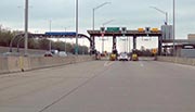
 South Beloit Toll Plaza" width="" height="" />
South Beloit Toll Plaza — Rockton
▸ GPS 42.445032000 X -88.992493000
NOTES:
Illinois Tollway manages this segment.
Exit 8 Illinois 173 — Machesney Park
▸ GPS 42.370145000 X -88.966597000
NOTES: West Lane Road
Illinois Tollway manages this segment.
Exit 12 East Riverside Boulevard — Loves Park
▸ GPS 42.319220000 X -88.964650000
NOTES:
Illinois Tollway manages this segment.
Exit 15 Bus U.S. 20 — Rockford
▸ GPS 42.271116000 X -88.964914000
NOTES: East State Street
Illinois Tollway manages this segment.
Exit 17 I–39 — Cherry Valley
▸ GPS 42.248555000 X -88.960784000
NOTES:
Illinois Tollway manages this segment.
Exit 20 Irene Road — Cherry Valley
▸ GPS 42.233003000 X -88.900729000
NOTES:
Illinois Tollway manages this segment.
Belvidere Toll Plaza — Belvidere
▸ GPS 42.233546000 X -88.853050000
NOTES: WB Only
Illinois Tollway manages this segment.

Belvidere Oasis — Cherry Valley
▸ GPS 42.233555000 X -88.834764000
NOTES:
Exit 25 Belvidere-Genoa Road — Belvidere
▸ GPS 42.233637000 X -88.818449000
NOTES:
Illinois Tollway manages this segment.
Exit 36 Illinois 23 — Marengo
▸ GPS 42.177619000 X -88.618019000
NOTES:
Illinois Tollway manages this segment.
Marengo Toll Plaza — Marengo
▸ GPS 42.167490000 X -88.589168000
NOTES: EB Only
Illinois Tollway manages this segment.
Exit 42 U.S. 20 — Marengo
▸ GPS 42.144505000 X -88.514702000
NOTES:
Illinois Tollway manages this segment.
Exit 47 Illinois 47 — Huntley
▸ GPS 42.122127000 X -88.432782000
NOTES:
Illinois Tollway manages this segment.
Exit 52 Randall Road — Elgin
▸ GPS 42.080703000 X -88.335700000
NOTES:
Illinois Tollway manages this segment.

Elgin Toll Plaza — Elgin
▸ GPS 42.070279000 X -88.306928000
NOTES:
Illinois Tollway manages this segment.
Exit 54 Illinois 31 — Elgin
▸ GPS 42.067342000 X -88.291494000
NOTES: North State Street
Illinois Tollway manages this segment.
Exit 56 Illinois 25 — Elgin
▸ GPS 42.066468000 X -88.263628000
NOTES: Dundee Avenue
Illinois Tollway manages this segment.
Exit 58 Beverly Road — Elgin
▸ GPS 42.066407000 X -88.223439000
NOTES: Sears Center Arena
Illinois Tollway manages this segment.
Exit 59 Illinois 59 — Bartlett
▸ GPS 42.066391000 X -88.193320000
NOTES: Sutton Road
Illinois Tollway manages this segment.
Exit 62 South Barrington Road — Hoffman Estates
▸ GPS 42.066438000 X -88.145035000
NOTES:
Illinois Tollway manages this segment.
Exit 65 North Roselle Road — Schaumberg
▸ GPS 42.063715000 X -88.079311000
NOTES:
Illinois Tollway manages this segment.
Exit 67 Meacham Road — Schaumberg
▸ GPS 42.059939000 X -88.044936000
NOTES: WB Enter/Exit ONLY
Illinois Tollway manages this segment.

Exit 68 I–290 / Illinois 53 — Schaumberg
▸ GPS 42.057447000 X -88.028421000
NOTES:
Illinois Tollway manages this segment.
Exit 70 Arlington Heights Road — Mount Prospect
▸ GPS 42.040488000 X -87.983735000
NOTES:
Illinois Tollway manages this segment.
Exit 73 Elmhurst Road — Mount Prospect
▸ GPS 42.018026000 X -87.940314000
NOTES:
Illinois Tollway manages this segment.
Exit 76 Lee Street / Illinois 72 / Allstate Arena — Des Plaines
▸ GPS 42.005363000 X -87.893887000
NOTES:
Illinois Tollway manages this segment.
Devon Avenue Toll Plaza — Des Plaines
▸ GPS 41.998602000 X -87.878097000
NOTES: WB Only
Illinois Tollway manages this segment.
Exit 77A O'Hare / I–90 EB to I–190 WB / I–294 SB — Des Plaines
▸ GPS 41.993260000 X -87.872219000
NOTES:
Illinois Tollway manages this segment.
Exit 77/77B I–294 NB (Tri-State NB) — Des Plaines
▸ GPS 41.990279000 X -87.867507000
NOTES: SB Use Exits 77 or 78
Illinois Tollway manages this segment.
River Road Toll Plaza — Rosemont
▸ GPS 41.985096000 X -87.857640000
NOTES: EB Only
Illinois Tollway manages this segment.
Exit 78 O'Hare / I–90 WB to I–190 WB / I–294 SB — Des Plaines
▸ GPS 41.983987000 X -87.848243000
NOTES: Eastbound traffic use Exit 77A
Illinois Tollway manages this segment.
Exit 79 North Cumberland Ave/IL 171
▸ GPS 41.984227000 X -87.836540000
NOTES: Start/End of Jane Addams
Illinois Tollway manages this segment.
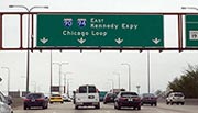
Kennedy Expressway — Chicago
▸ GPS 41.985096000 X -87.857640000
NOTES: to Chicago Loop
Illinois Tollway manages this segment.
Advertising AdvertisingJourney to key destinations around and adjacent to Illinois!
 Chicagoland - Northwestern Indiana
 Communities in this metro area include Chicago, Aurora, Oak Lawn, Des Plaines, Waukegan, Highland Park, Gary, Indiana, Schaumburg, Naperville, Oak Brook, and Joliet.
Individual toll maps for this region are listed below.

Roads Within Region
 Northern Indiana
 Communities in this metro area include Gary, South Bend, Elkhart, Portage, and Fremont.
Individual toll maps for this region are listed below.

Roads Within Region
Advertising Advertising© 2009 - 2024 Turnpike Information Company
TURNPIKES.COM is The Turnpike Authority ®
Turnpikes.com is the new home of TurnpikeInfo.com. This site is currently in BETA. The pages you can view are ready for public use, although you may encounter mild performance issues, not related to the accuracy of any data.
To view our original site, during this transition, visit TurnpikeInfo.com.
Turnpikes.com and Turnpike Information Company are not affiliated with any government agency. We work with government agencies and their representatives to provide you with accurate information and toll data.
All product names, company names and third-party logos are trademarks (™) or registered (®) trademarks of their respective holders. Their use is for reference only and does not imply any affiliation or endorsement of any kind.
Roadway and traffic camera feeds originate from third-party sources, and no camera imagery is maintained on our servers. However, some agency camera imagery may be stored for a short period of time. Contact media@turnpikes.com for information.